Blencathra Facts: a Wainwright Favourite

There are many mountains higher in the British Isles, and plenty that are more popular to climb. But Blencathra has a unique charm and attraction of its own.

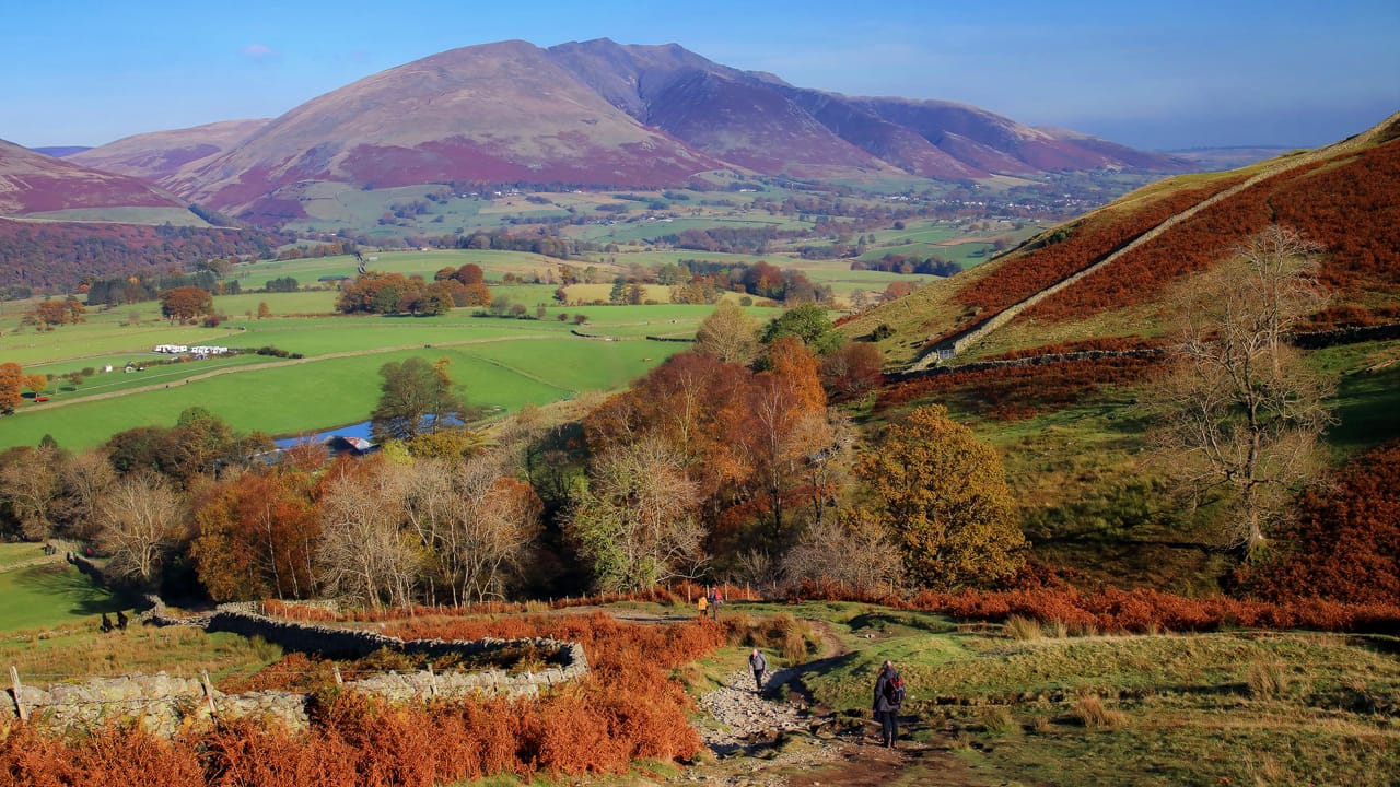
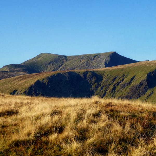
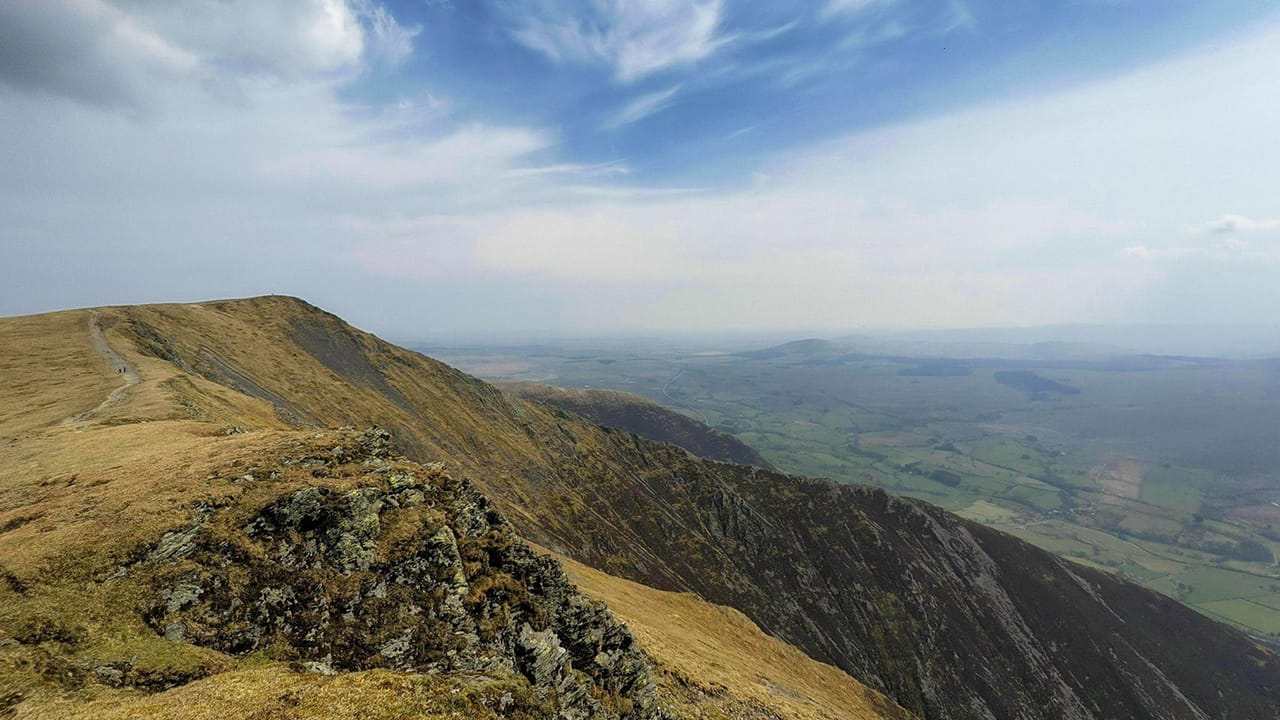
Also known by its alternative name Saddleback, the fell has many different “faces”. From the south Blencathra has smooth shoulders leading to a jagged and craggy summit. From the east it becomes clear where Blencathra gets its alternative name from. The summits of Hallsfell Top and Atkinson Pike present a shape like a chair back or a saddle.

Blencathra was one of Alfred Wainwright’s favourite fells, and wrote more about this fell than any other. As we’re unlikely to do any better, we’ll begin this post with a quote from the man himself:

“Blencathra is one of the grandest objects in Lakeland. And one of the best known. Seen from the south-west, the popular aspect, the mountain rises steeply and in isolation above the broad green fields of Threlkeld, a feature being the sweeping curve leaping out of the depths to a lofty summit-ridge, where the skyline then proceeds in a succession of waves to a sharp peak before descending, again in a graceful curve, to the valley pastures far to the east.”

Blencathra: the beginning of the Lake District

Looking west from the summit of Souther Fell takes in Blencathra and Bannerdale Crags. Photo by Mick Knapton, licensed CC-by-SA-3.0
Photo by Mick Knapton, licensed CC-by-SA-3.0

Blencathra is part of the Skiddaw Group, the oldest rocks in the Lake District. The group is roughly 500 million years old. Skiddaw and Blencathra are, thus, the oldest mountains in England.

They formed as black muds and sands settling on an ancient seabed. Over time they rose up and crushed together over the course of millions and millions of years. More recent periods of global cooling and Ice Ages covered much of Britain in sheets of ice. Some of these were several miles thick. As the planet warmed up, the glaciers carved out the deep gills and valleys characteristic of the Northern fells.

Blencathra facts and figures

Lake District image by Emphyrio from Pixabay
Image by Emphyrio from Pixabay

Blencathra is 868 m/2,848 ft above sea level, making it the 14th highest Lake District peak. It is the 290th highest peak in all the British Isles.

Blencathra actually has 6 tops, and they are (in no particular order):

  • Blease Fell
  • Gategill Fell
  • Hallsfell
  • Atkinson Pike
  • Doddick Fell
  • Scales Pike

Blencathra or Saddleback: what’s in a name?

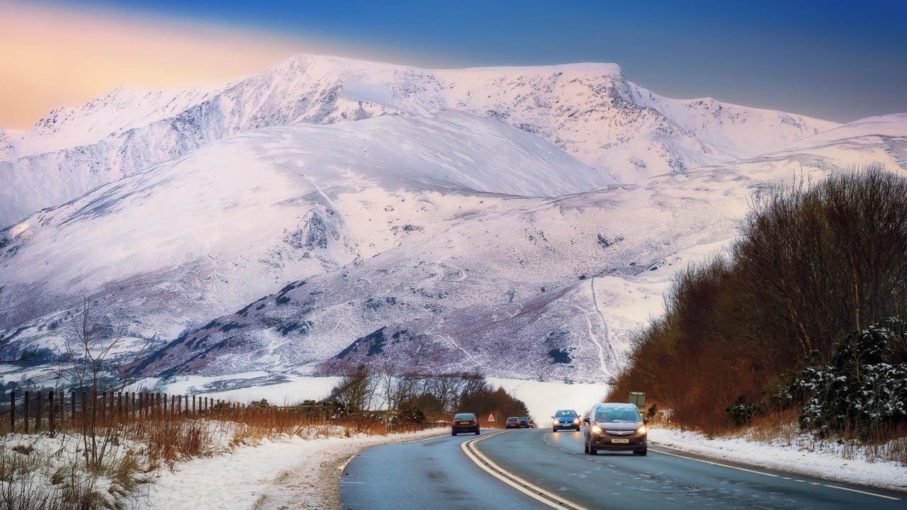
Winter landscape in the Lake District

Blencathra is somewhat unusual in the Lake District for having two names in common usage.

In the late 1800s to early 1900s the mountain’s name was Saddleback, and marked so on Ordnance Survey maps. The name references the fell’s profile when viewed from the east. The ridge between Hallsfell Top and Atkinson Pike dips in the middle and puts one in mind of a chair back or a saddle.

When Alfred Wainwright arrived in the Lake District he climbed the fells for his guidebooks. He popularised the use of the fell’s older Cumbric name: Blencathra. This has stuck ever since. Nowadays, Ordnance Survey maps reference both names for the fell as Blencathra/Saddleback.

There’s a few theories about what the fell’s old Cumbric name means:

  1. The predominate theory is that it’s made from two Cumbric elements. Blain, meaning “top” or “summit”, and cadeir meaning "“seat” or “chair”. This gives us “the summit of the chair/seat-like mountain”;
  2. Another theory states that the second part of name comes from the Cumbric word carthwr. This comes from Middle Welsh meaning “working horse”, referencing the dipped back of an aged working animal;
  3. A more obscure idea suggests that the second aspect of the fell’s name could come from the Middle Irish personal name Carthach. How well Middle Irish was known thousands of years ago in Cumbria is unclear;
  4. Finally, local folklore suggests that Blencathra can translate as “Arthur’s Seat”. This references the mythology of King Arthur i.e. “-athra” to Arthur.
First sight of Blencathra. Photo by Andrew Bowden, licensed CC-by-SA-2.0
Photo by Andrew Bowden, licensed CC-by-SA-2.0

Cumbric is an ancient Brittonic language, related to Old Welsh. That’s why there is a similarity between the name Blencathra and Welsh places like Blaenau Ffestiniog. Here, blen and the modern Welsh blaen both mean “summit, top”. Cumbric went extinct in the 12th century after the Kingdom of Strathclyde folded into the Kingdom of Scotland.

Cumbric survives in place names around Cumbria and northern England, such as in Carlisle and Penrith. Also, the ancient sheep-counting numbering system (yan, tyan, tethera etc.) probably originates from Cumbric.

Blencathra’s industrial and farming heritage

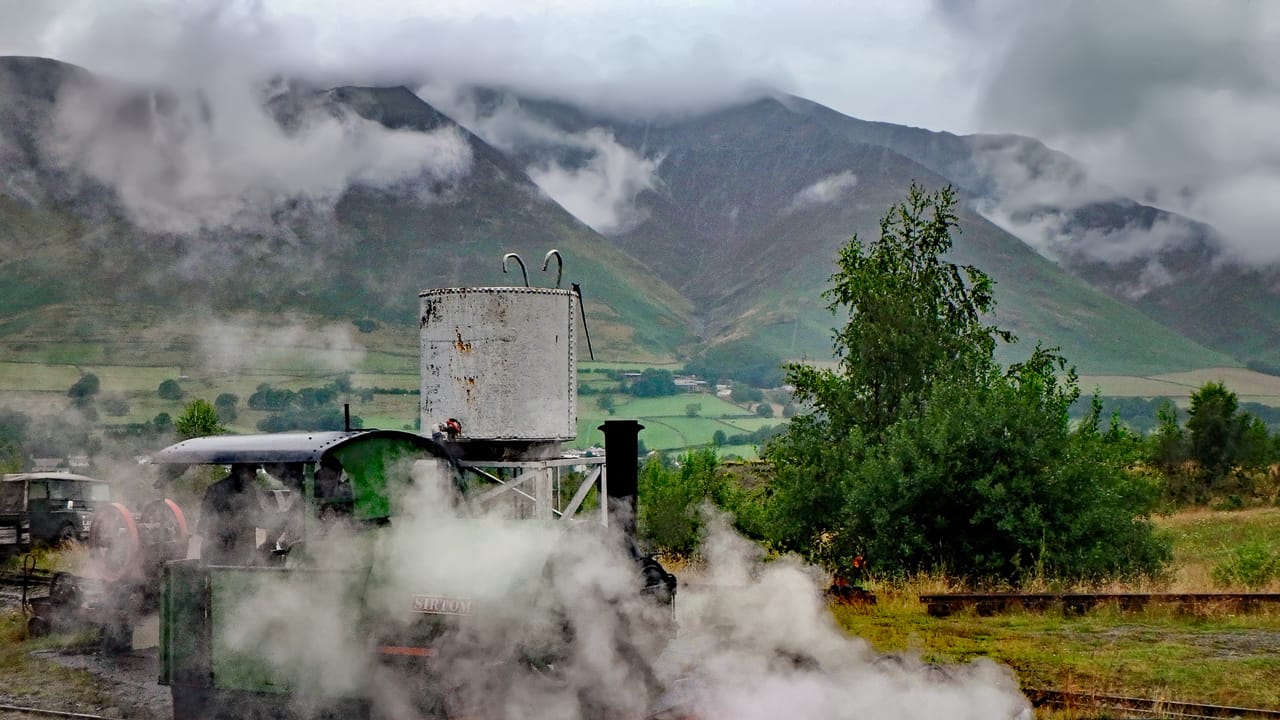
Threlkeld Quarry Annual Steam Gala. Photo by ARG_Flickr, licensed CC-2.0

Like other Lake District fells, Blencathra has seen centuries of sheep grazing activity.

Less known is Blencathra’s industrial and mining heritage. Back in the late 19th and early 20th centuries, the fell was the site of several mines. The main one was Threlkeld Mine & Quarry, located near the base of Hallsfell. Operations ran for around 50 years between 1879 to 1928, mining zinc and lead ores. A Mr. H. Harkewitz opened the quarry to supply railway ballast to the Penrith–Keswick line. Track ballast is the loose rocky trackbed upon which railway lines and laid down.

Near the turn of the 20th century, demand had risen and the quarry was outputting 80,000 tons a year. The quarried stone was used for, and by, a variety of schemes, including construction of the Thirlmere Reservoir by the Manchester Corporation.

Nowadays Threlkeld Quarry has transformed into a museum for public enjoyment.

Blencathra: a mountain up for sale

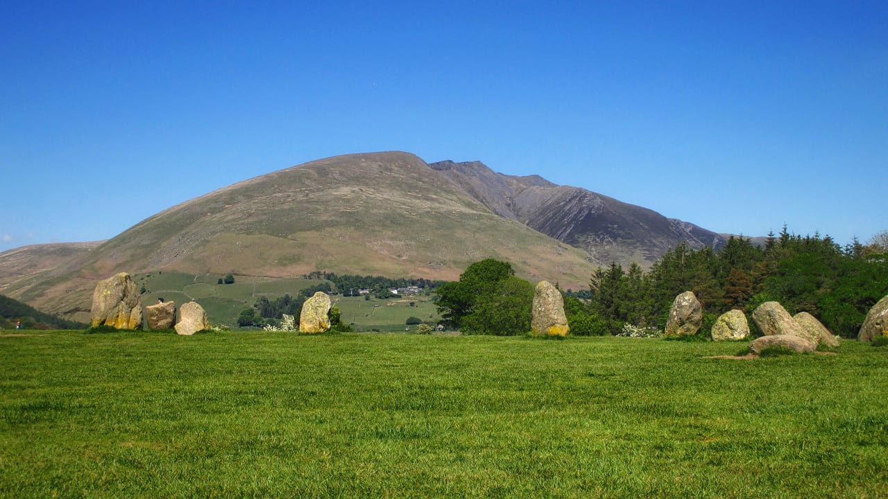
Castlerigg stone circle, 2 miles east of Keswick, Cumbria, with Blencathra in the background. Photo by Antiquary, licensed CC-4.0
Photo by Antiquary, licensed CC-4.0

In 2014, something rather unusual happened in the Lake District: a mountain went up for sale.

You see, Blencathra is owned by the 8th Earl of Lonsdale, Hugh Clayton Lowther, part of the ancient Lowther family and heir of the Lowther Settled Estates. The Lowther family have been major landowners in Cumbria since 900AD. The fortunes of the Lowthers has waned since the 20th century. Even so, the current Earl of Lonsdale still owns around 5,000 acres of land, Blencathra included.

In 2014, the Earl announced that he was listing the mountain, as well as the Lordship of the Manor of Threlkeld, for sale. The guide price was £1.75 million. This was to settle an inheritance tax bill.

This news immediately stirred the minds of the public and press alike. A community group soon formed called the Friends of Blencathra. Their goal was to raise enough funds to make a bid for the mountain, keeping the land out of private interests. Another major Lake District landowner, the National Trust, supported the group’s plans and decided not to bid.

By November 2015, the mountain was no longer on the market. By that point, Friends of Blencathra had only raised £246,650 despite wide public support. In May 2016 Blencathra was officially withdrawn from sale after the Earl had identified other means of settling his tax bill.

The Friends of Blencathra group began winding up operations and returning donations. The remaining funds raised that couldn’t be returned were donated to five local charities, and the group ceased to be in 2019.

Who knew one could own a mountain, never mind sell one?

Blencathra walks and routes

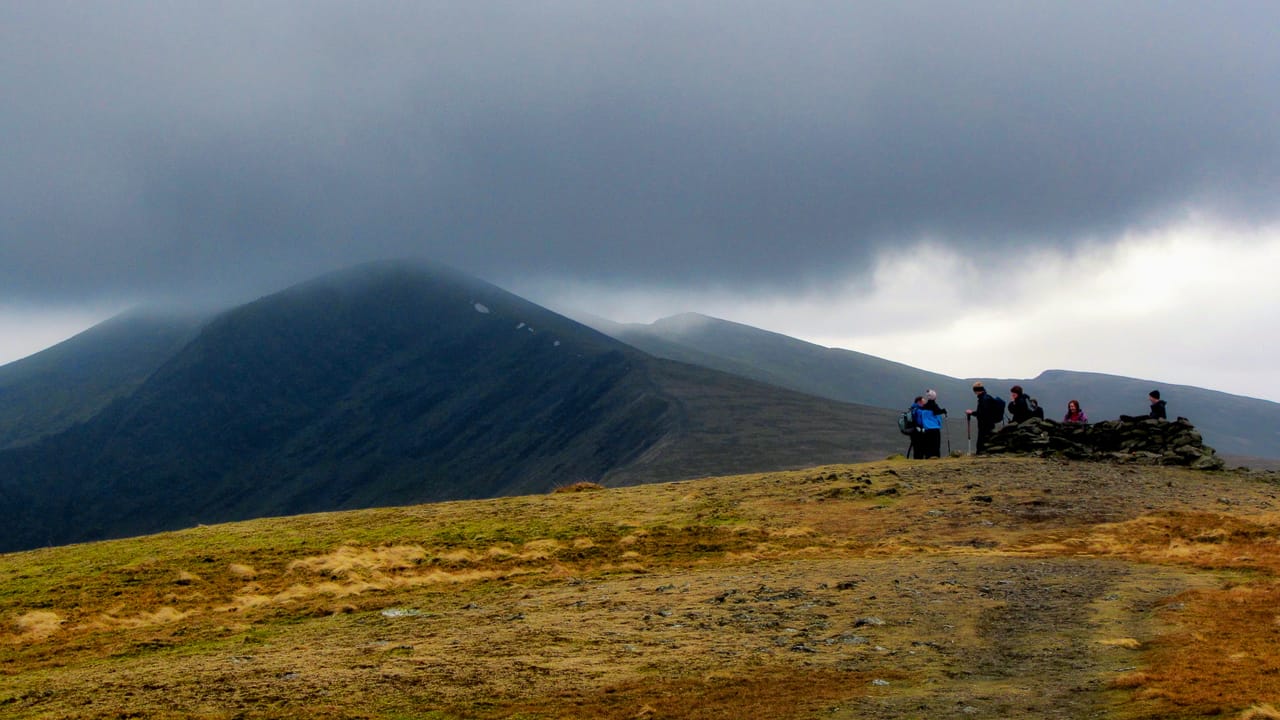
Blencathra in cloud. Photo by Peer Lawther, licensed CC-2.0
Photo by Peer Lawther, licensed CC-2.0

There are many ways to skin the proverbial cat and summit this popular mountain.

Before we detail these routes and ascents, though, we must be responsible people.

Before tackling any of these ascents, you must ensure you have the necessary equipment and knowledge. That means:

  • a solid pair of walking boots;
  • a paper OS map of the route;
  • a compass (and you know how to use it in reference to the map);
  • adequate outdoor clothing for the current and expected weather conditions;
  • supply of water and food.

Let close friends or family know what time you’ll be setting off on the walk and what time you expect to return.

For checking specialised weather in the area, we can recommend:

If you are unable to call 999, you can text the emergency services. You’ll need to set it up in advance, find out how to do so here.

One of the easiest ways to communicate your precise location is to use What3Words. What3Words divides the world into 3x3 metre squares, and gives each square a unique and memorable three-word name. Easier to remember and communicate compared to a random string of numbers!

If you’re facing problems on Blencathra, call the emergency services and ask for Keswick Mountain Rescue.

All that being said… here’s some ascents of Blencathra.

1. Via Sharp Edge: the way of the thrill seeker

Blencathra Photo © Colin Kinnear (cc-by-sa/2.0)
Photo © Colin Kinnear (cc-by-sa/2.0)

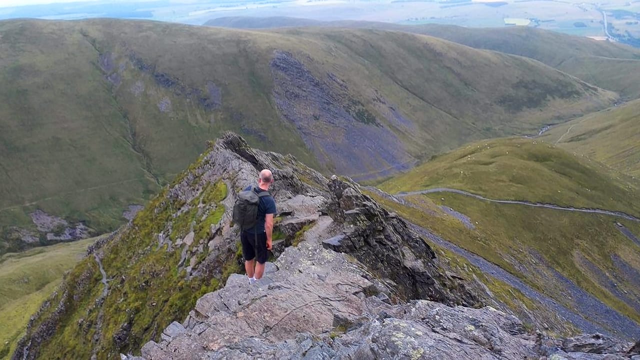
Helvellyn isn’t the only mountain in the Lake District with vertiginous ridges. Blencathra has one too, known appropriately as Sharp Edge. Alfred Wainwright himself, when detailing this route, noted that “The crest itself is sharp enough for shaving (the former name was razor edge) and can be traversed only à cheval at some risk of damage to tender parts.” That’s putting it mildly!

This route is not for the fainthearted. We don’t recommend tackling this during the colder months unless you are already vastly experienced and skilled in mountaineering.

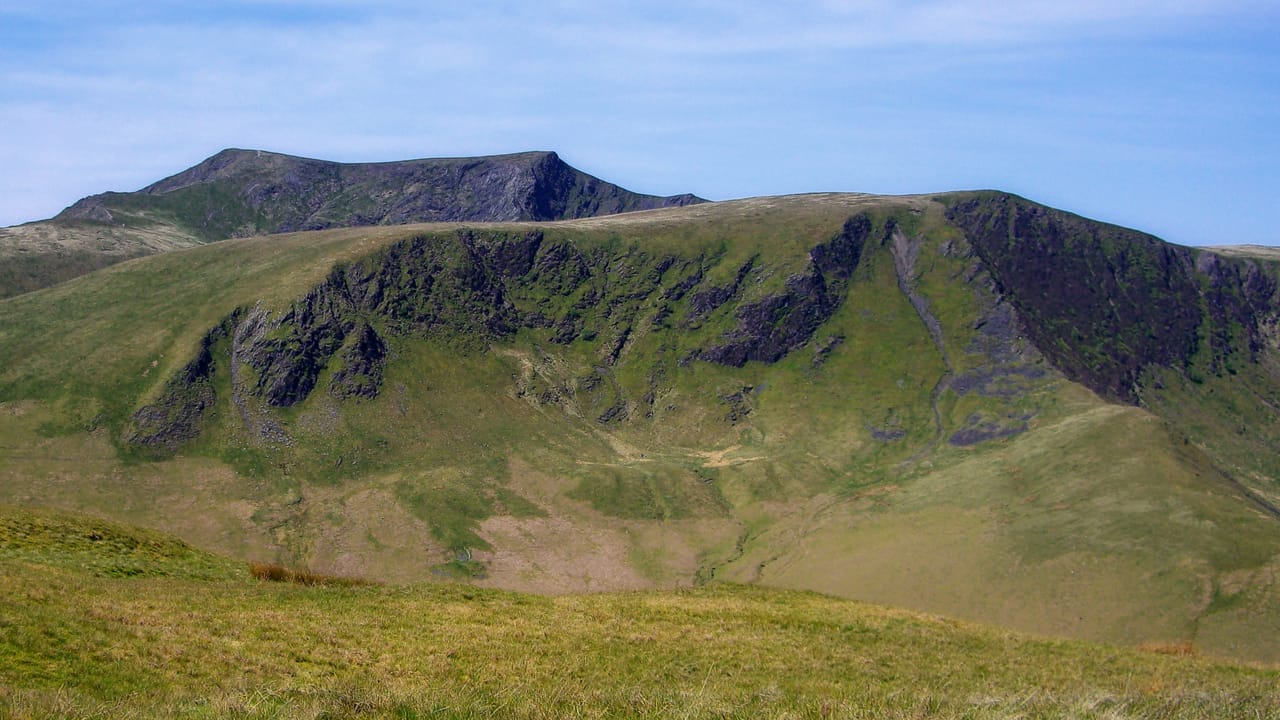
Tap/click for a bigger view

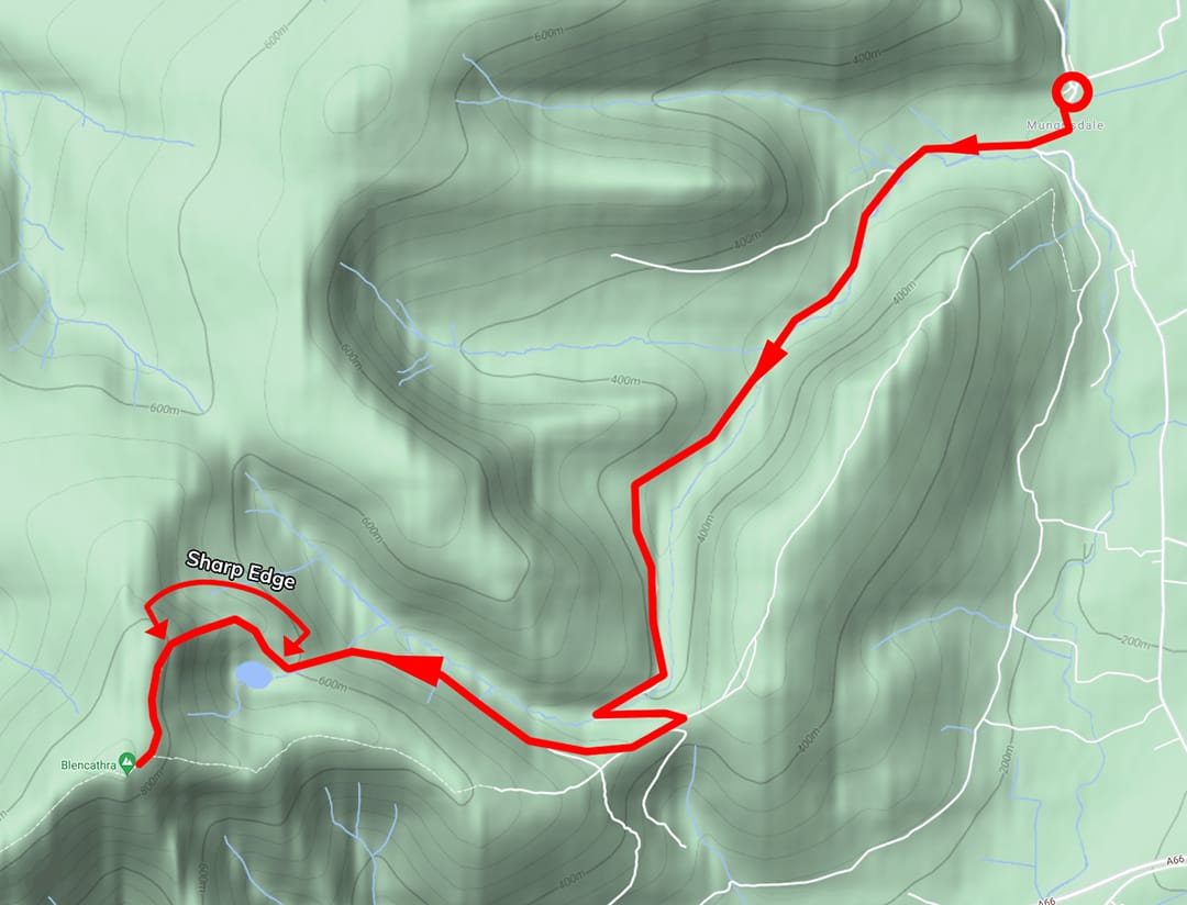
The hike begins at the village Mungrisdale. The village is small but it does have “official” parking opposite the Village Hall (///meanings.driver.heartburn), with an Honesty Box. Follow the road north, walking past the small bridge, and turn left at the red phone box (///pinches.shifts.trainers). Follow this path into the valley of Mungrisdale itself. You’ll want to ensure that the beck, the Glendaramackin, is by your left side all the time. Follow this path, which can be boggy at times, for about a mile southwest, crossing the ford at Bannerdale Beck (///fizzle.booklets.album).

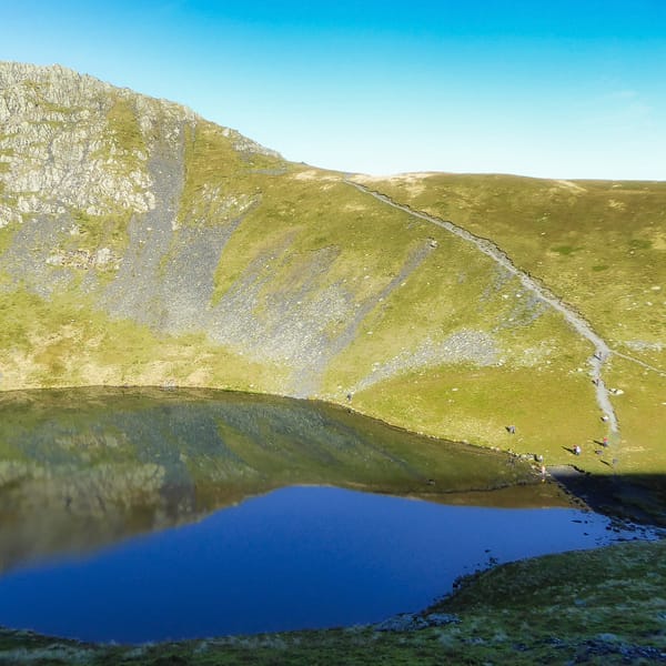
Scales Tarn and Sharp Edge. Photo by Andrew Bowden, licensed CC-by-SA-2.0
Photo by Andrew Bowden, licensed CC-by-SA-2.0

The path will start to rise away from the river at this point; ensure that it’s still to your left. You’ll ford another small beck (///spans.irony.choirs) before the path returns back down towards the river. After about 4 miles of walking you’ll find a footbridge at the southernmost point of the Glendaramackin (///frogs.reform.backhand). Cross the footbridge, and take the zigzagging path up the fell side, heading west (///cigar.mallets.shortcuts) . You’ll be above the river once again, this time it should be on your right. Follow the path as it bends west and head straight towards Scales Tarn (///qualified.blunders.destiny).

That’s the easy part done, which also presents a good opportunity to assess your situation, the weather, and your fortitude. If all is well, you can begin tackling Sharp Edge. Take the path north of Scales Tarn (///congested.having.married), which quickly ascends up onto Sharp Edge. Scrambling is required, and you may well be spending the ascent up this ridge on all fours.

About 150+ metres of ascent, you should find yourself up onto the flat plateau of Atkinson Pike (///petal.beanbag.magazines), 845 m/2,772 ft above sea level. It’s now a simple job to follow the ridge line south towards the summit of Blencathra at Hallsfell Top (///club.dummy.branded).

2. Via Blease Fell: a grassy stroll

Blencathra landscape in the Lake District

If you want an easier route try via Blease Fell, the smooth western shoulder of Blencathra.

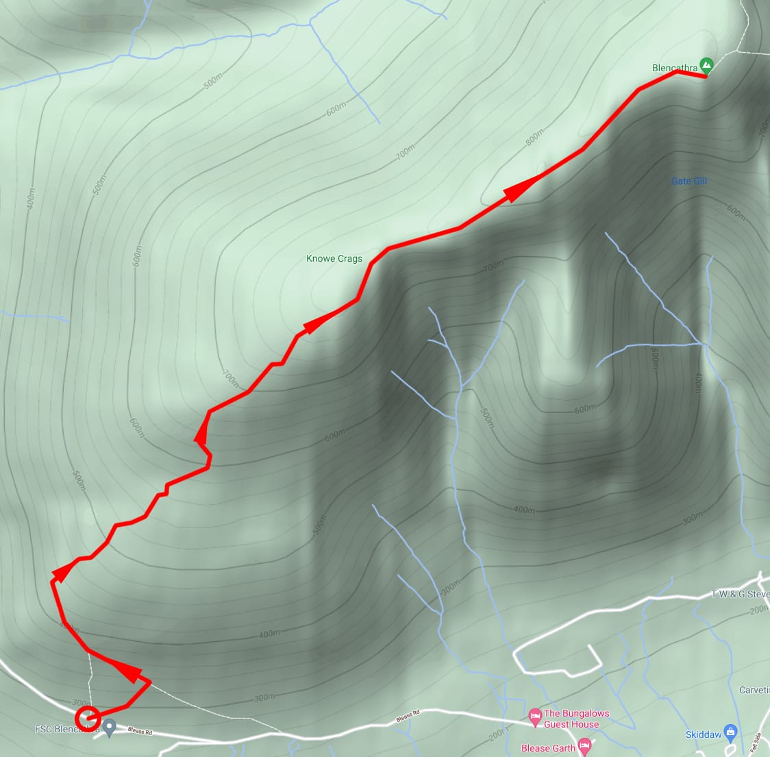
Tap/click for a bigger view

Park at the Blencathra Centre (///sized.pirates.ketchup), the path north up Blease Fell starts here. After about 70–80 m of ascent, the path will turn sharply left (///renovated.post.offices). Stay on the path as it ascends up the smooth fell, heading northwest before curving round northeast, aiming for the summit. Continue to follow the clear path up northeast. At about 600 m above sea level the gradient gets steeper for about 50 m or so (///erupts.cowering.changed), before gently ascending northeast once again.

After about 800 m of ascent you will have reached Knowe Crags (///unicorns.verifying.flashing). That’s the hard part done. Well done! You should see the summit of Blencathra, Hallsfell Top, ahead northeast. Follow the ridge line towards the summit, taking care to stay away from the sheer drops to your right.

The views from Blencathra, some of Lakeland’s finest

Blencathra to Coniston. Photo by b3tarev3, public domain.
Photo by b3tarev3, public domain.

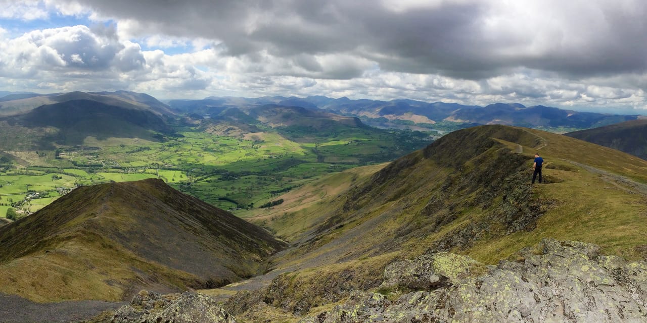
As expected from an isolated fell 860+ m above sea level, the views from the summit are spectacular.

Looking west, across Blencathra’s ridges, is the fell’s taller neighbour, Skiddaw. Scanning from west to northeast, one can see as far as the Galloway mountains (64 miles/104 km away) and the Southern Uplands of Scotland (61 miles/99 km away). Towards the northeast there are views of the Cheviots (67 miles/109 km away) in Northumberland.

The Northern Pennines (23 miles/37 km away) make up most of the view eastward, as well as the Helvellyn massif. The views south to southwest comprises most of the major Lake District peaks as well as Keswick town far below and Derwentwater. On an especially clear day, it’s possible to spot westwards the Isle of Man (65 miles/104 km away) and even the Mourne Mountains (123 miles/192 km away) of Northern Ireland.

Have ewe climbed Blencathra?

Have ewe tried tackling Sharp Edge? Or just gazed at Blencathra's beautiful shape from afar? Let's have a natter in the comments below, or join the flock on our Facebook, Twitter, or Instagram, or email us.

Featured Product

Lake District Mountain Rescue, Herdy Fundraiser Ewe Tube

Mountain Rescue Ewe Tube